


sur les crêtes du Pilât depuis la Jasserie

LydiaMich
User

Length
8.9 km

Max alt
1391 m

Uphill gradient
257 m
Km-Effort
12.3 km

Min alt
1279 m

Downhill gradient
257 m
Boucle
Yes
Creation date :
2025-08-08 07:22:36.493
Updated on :
2025-08-08 09:51:15.063
2h28
Difficulty : Medium

FREE GPS app for hiking
 SityTrail
IGN / Geographical institutes
SityTrail Plus
The world is yours!
About
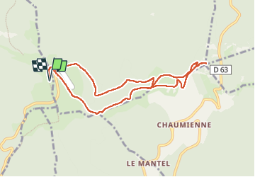
Trail Walking of 8.9 km to be discovered at Auvergne-Rhône-Alpes, Loire, La Valla-en-Gier. This trail is proposed by LydiaMich .
Positioning
Country:
France
Region :
Auvergne-Rhône-Alpes
Department/Province :
Loire
Municipality :
La Valla-en-Gier
Location:
Unknown
Start:(Dec)
Start:(UTM)
623224 ; 5027449 (31T) N.
Comments